Optimum Drain
Elevation Maps
Optimum Drain Locations
Optimum Drain Locations

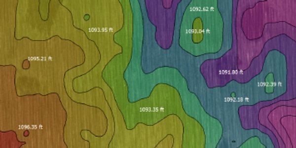
Optimum Drain Elevation maps are created from the use of RTK GPS surveying or LiDar Imagery scanning the topography of your field. Elevation Maps give growers a great reference of the different changes in topography.
Optimum Drain Locations
Optimum Drain Locations
Optimum Drain Locations

Once elevation maps are created Optimum Drain Locations are established. Drains are created and designed to insure the least amount of soil is being removed to allow water to flow from the field. Optimum Drain Maps can also be utilized to acquire any permits needed in your local region.
Wetness Potential
Wetness Potential
Wetness Potential

Wetness Potential Maps are a great tool for growers to visually see the locations that water will natural pool. The Optimum Drain locations are layered over an wetness potential map to better highlight the areas of the field that will be drained via Optimum Drainage maps
Monitor Files
Wetness Potential
Wetness Potential

Optimum Drain Maps are customizable to Display on all main stream GPS water management systems such as, John Deere, Trimble WM Drain, and Ditch Assist. Insuring the producer is creating the perfect drain!
Land Leveling Mapping
Detailed Grading Report
Detailed Grading Report
Detailed Grading Report

Customers are provided with a detailed grading report which outlines all aspects of the specs to complete the grading work. these include Cut area in acres, Cut Volume, Fill Volume, and slope percentage.
Natural Surface Map
Detailed Grading Report
Detailed Grading Report

Natural Surface maps are built from RTK GPS surveying or through available LiDar in the area. Note: not all areas current have LiDar available.
Design Map
Cut Fill Map
Cut Fill Map

Design maps are created from a combination of the Natural surface map and slopes required to properly drain low areas in the field.
Cut Fill Map
Cut Fill Map
Cut Fill Map

Cut & Fill maps are created from the differences between the natural surface map and the design map. This map provides the data and visual needed to indicate which low spots are needing to be filled and high spots needing to be cut.
